The technological deployment for monitoring the Cumbre Vieja volcano on La Palma is being extraordinary. From the data collected by the sensors and the know-how of the scientists deployed throughout the island the forecasts that set the pace of evacuations depend, returns and decision making in general.
In addition to the need to know the concentration of sulfur dioxide gas, which is elementary to study the evolution of the volcano, the use of thermography is being the other main pillar on which all scientific predictions are based. Knowing the heat that is released from the entire volcanic zone and studying its evolution allows us to identify new eruptive zones that are otherwise impossible to detect.
This technology is well known by the Canary Islands Volcanological Institute (INVOLCAN), which has been using it for many years in the different volcanoes that they have cataloged on the islands and has already applied it on other occasions; as in his scientific participation in the eruption of the Fogo volcano (Cape Verde) in 2014.
The volcano thermometer
The technology behind thermography is not really new. To do it infrared sensors are used which are nothing more than cameras capable of detecting such a narrow electromagnetic spectrum. “It’s based on the same principle as night vision goggles that they use in the army “, has told EL ESPAÑOL – Omicrono Arnau Folch, volcanologist at the Barcelona Institute of Geosciences under the CSIC.
Thermography on foot
The infrared spectrum is comprised of the radiation in the form of heat that emits any object. Applied to the volcanic eruption of La Palma, the subjects to study are the plumes – the materials projected into the atmosphere – and the different lava flows that have been generated since last Sunday.
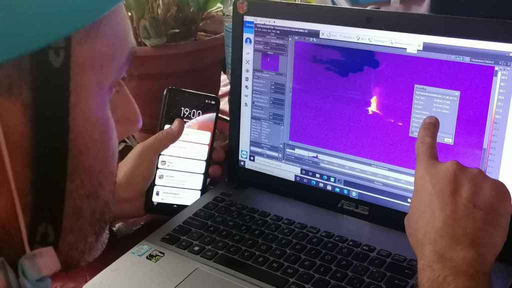
The sensors used by INVOLCAN are capable of detect that infrared radiation and provide scientists with a measurement in degrees centigrade. By georeferencing that temperature data, which can be taken from miles away, and placing it in a geographic information system, heat maps can be created. Which can then be superimposed to see how it has evolved in recent days.
The best example of this technology has been possible since the pandemic started and the access controls were filled with security guards with infrared thermometers in their hands. Or even in automated systems at airports made up of infrared cameras that still today measure the body temperature of the passengers passing by one by one.
“Thanks to the images obtained by thermography you can see the size and distribution of the fissures where the lava comes out“Folch continues. Something that at first glance is really complex.” It helps to complete the information that the cameras of the visible spectrum collect.
Thermographic measurement station
By land and air
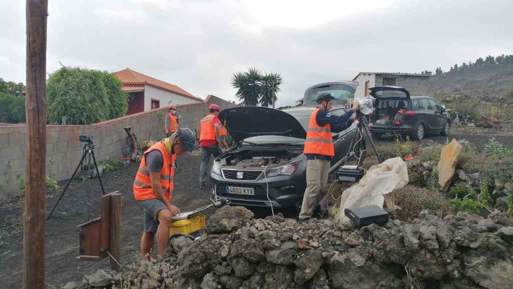
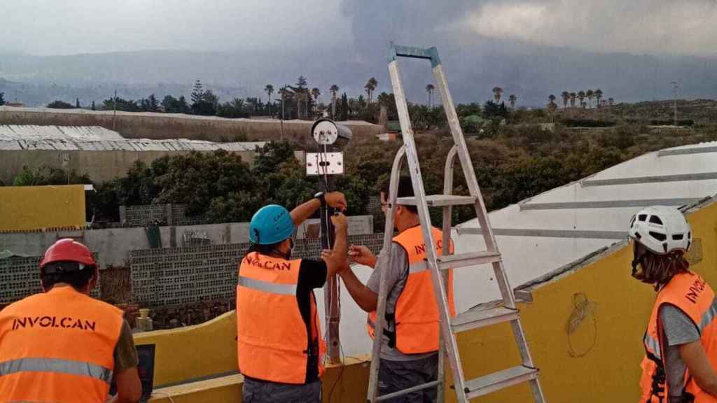
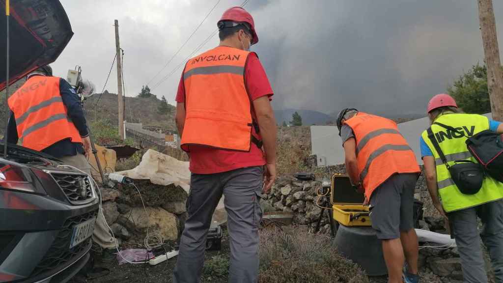
As is the case with the measurement of sulfur dioxide, both terrestrial and aerial means are being used for data collection of thermography. The former are comprised of various stations that INVOLCAN has placed in strategic locations from which to take thermographic images on time and transmit them wirelessly to command centers.
They are also being carried out measurements at the foot of the wash fronts of lava that provide an idea of the outside temperature of the molten rock that has already buried entire villages.
Taking thermographic data
Although undoubtedly the most valued perspective by scientists is the aerial one thanks to which measurements can be obtained from totally inaccessible areas on foot or by vehicle. Precisely for this purpose, last Saturday a Cessna Skymaster aircraft from the Ministry for Ecological Transition joined the surveillance work, which is normally used for media coordination in forest fires, but thanks to its built-in infrared camera is being a great help to scientists.
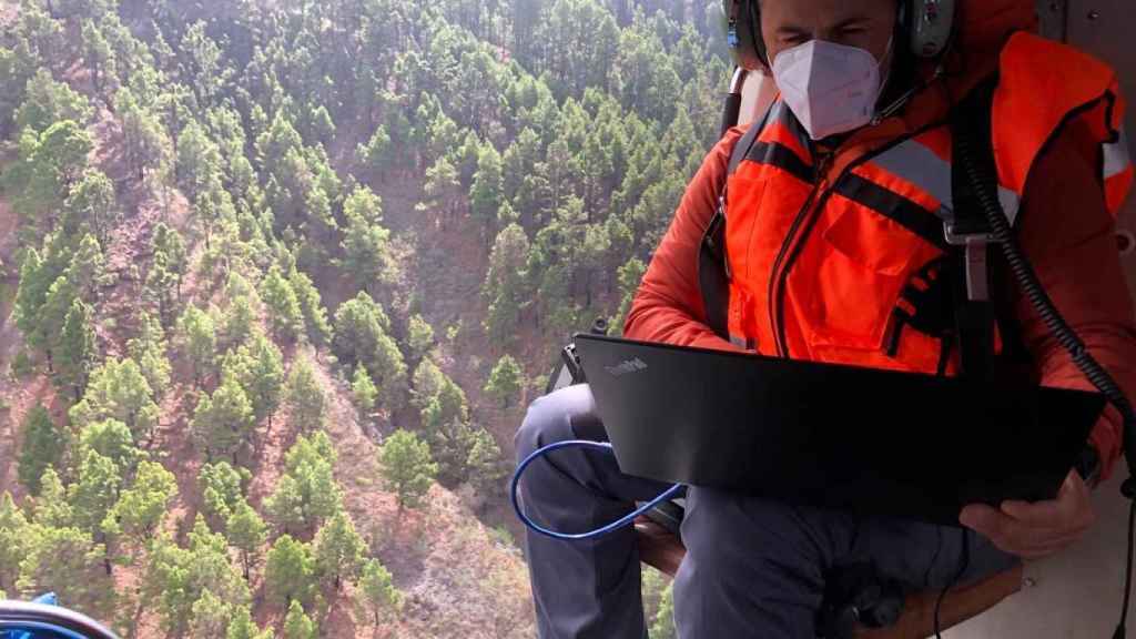
Also from the air, a helicopter of the Emergency and Rescue Group of the Government of the Canary Islands is being used as makeshift thermographic data collection center. In this case, a technician makes infrared measurements of the volcano using a handheld camera hundreds of meters or even kilometers away from the focus.
Thermography data collection
You may also like…
Follow the topics that interest you
Reference-www.elespanol.com