Snow and winter storm warnings have been issued for mountain passes in the interior of southern British Columbia.
![]()
According to Environment Canada, heavy snow accumulations are forecast for Highway 3 and the Coquihalla Highway from Saturday through Sunday morning.
For Highway 3, 6 to 8 inches are projected between Hope and Princeton, while 12 to 16 inches are projected to fall between Paulson Summit and Kootenay Pass.
Read more:
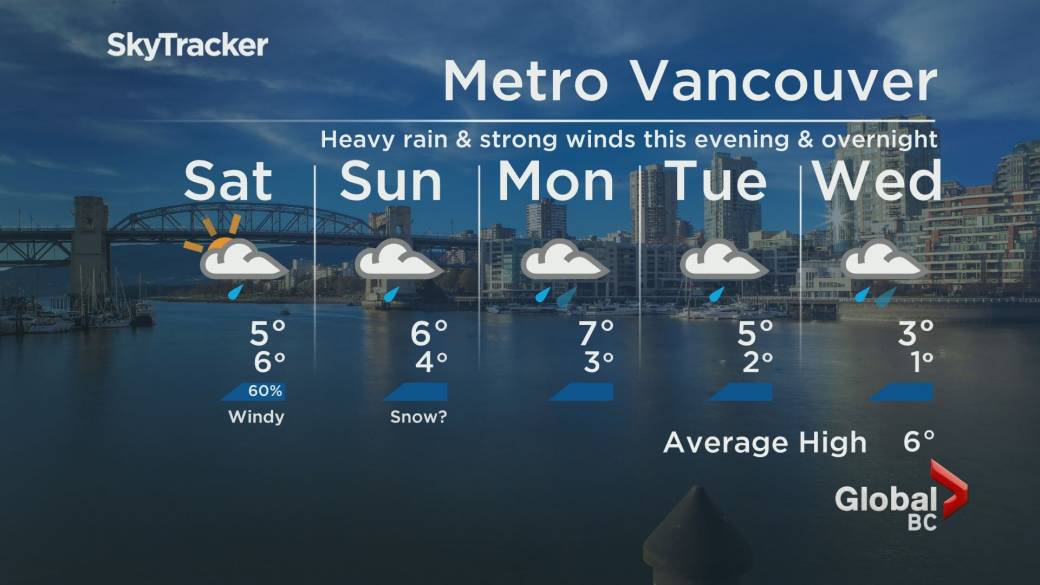
Wind advisories issued for much of southwestern Alberta
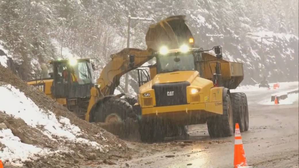
For Coquihalla, 25-35 cm is forecast between Hope and Merritt, although that section of the popular highway is closed as crews repair various sections that were damaged by flooding last month.
The national meteorological agency also noted that southwest winds of 50 km / h with gusts of up to 70 could also generate snow.
“A frontal system of the Pacific is giving snow to the interior of BC,” said Environment Canada. “The sometimes heavy snow will continue through Sunday afternoon with expected total accumulations of 30 to 40 (cm).
“Also, near zero visibility is possible with blowing snow due to strong winds today and tonight.”
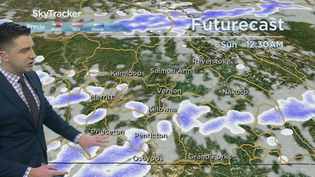
Heavy snowfall is also expected in Kootenays.


In the Arrow Lakes and Slocan Lake region, 15-20 cm is expected as the cold front arrives and stops over the region, resulting in narrow bands of heavy snow.
“Any community under these bands will experience heavy snowfall while a slight accumulation of snow or even light rain will occur a few kilometers down the road,” Environment Canada said.
In the Elk Valley region, Fernie and Morrisey are expected to receive 12 to 16 inches, while Sparwood is forecast 6 to 10 inches.
“Consider postponing non-essential travel until conditions improve. Rapidly accumulated snow could make travel difficult in some places. Visibility can be suddenly reduced at times in heavy snow. “
Snowstorm advisories are also in effect for the North Columbia, North Thompson, South Thompson, and Kinbasket regions.
“A cold front running through the interior of British Columbia will bring high winds and short bursts of heavy snow that will create dangerous conditions with a sudden reduction in visibility,” said Environment Canada.
“Those in the area are advised to keep an eye on the sky and prepare for the possibility of these dangerous conditions if traveling or recreating outdoors.
Environment Canada says blizzard advisories are issued when conditions are favorable for brief but intense bursts of heavy snow that produce near-zero visibilities.
To know the latest road conditions throughout the province, visit DriveBC.
© 2021 Global News, a division of Corus Entertainment Inc.
Reference-globalnews.ca