These are not places we want to invade
warned Jan Sebastian LaPierre, of the marketing company A For Adventure of Dartmouth, Nova Scotia. You probably shouldn’t go with a large group and you should try to touch as little as possible.
The public can visit many environmentally sensitive areas, he said, if there is the right infrastructure, such as boardwalks and trails.
Interactive maps and videos
Chris Surette, business partner of Jan Sebastian LaPierre, has noticed a recent trend of conservation groups wanting to create interactive maps and videos to try to get people to know and love wetlands and rare habitats.
The Nature Council of New Brunswick has done a lot of mapping, he gives as an example. Among the most interesting is that of the Meduxnekeag River, a tributary of the Saint John River, and its reserve which includes more than 1000 acres of Appalachian hardwood forests.
Over 180 species of trees, plants, lichens and mosses live here, including 43 rare species and many found nowhere else in Atlantic Canada.
Thanks to the trails and infrastructure, more than 3,000 students can visit the reserve each year, noted Chris Surette. According to him, they have fun identifying plants using the iNaturalist app or geocaching and also learning something in the process.
teaching nature
Ultimately, it’s about teaching them about nature, says Chris Surette, and creating a culture of understanding the importance of conservation.
The St. Mary’s River Association in Nova Scotia has just launched an online map project as well, said Jan Sebastian LaPierre.
The river is well known for salmon fishing, he noted. It is also home to many other species and has beautiful hills along its banks.
It took decades to consolidate some properties, on a mix of private and public land, but there are now plenty of access points for those who want to travel by boat, bike or on foot, the expert says.
Other projects
Chris Surette and Jan Sebastian LaPierre have been personally involved in a few other mapping projects, in conjunction with the Canadian Wildlife Service.
One of these includes Big Glace Bay Beach, which is surrounded by the community of Glace Bay, Nova Scotia.
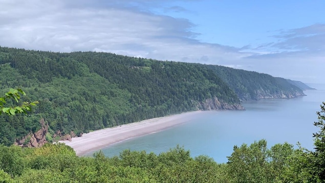
Another of the mapping projects they have been working on involves the Shepody Hills south of Moncton on the shore of the Bay of Fundy.
They created a video in collaboration with naturalist, poet and author Harry Thurston.
The Shepody Hills have had a lot of human habitation for a long time, says Jan LaPierre, and have now returned to a more natural state.
Another important natural area is nestled next to the community of Kentville, Chris Surette said, in Nova Scotia’s fertile Annapolis Valley.
Ducks Unlimited is piloting an interactive map project in the Miner Marsh.
The Miner family has reached an agreement to transfer their farmland and restore it to its natural state.
The swamp opened as a nature reserve in 2010. Hundreds of people visit it daily using its walking and biking trails.
According to a CBC report
Reference-ici.radio-canada.ca