The ongoing Winter Storm Quinlan is moving across the central U.S. this Friday night into Saturday, followed by a Major Arctic Cold Outbreak arriving in its wake from Canada. With the progress of the frontal system towards the East Coast Saturday night, record-cold temperatures are forecast for the Southeast. Quinlan will then explosively deepen into the next Nor’Easter storm, thanks to the Polar Vortex lobe clashing the Arctic air into the tropical airmass, leading this bomb cyclone to bottom out at 930 mbar low over the Labrador Sea on Monday.
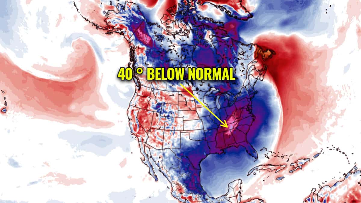
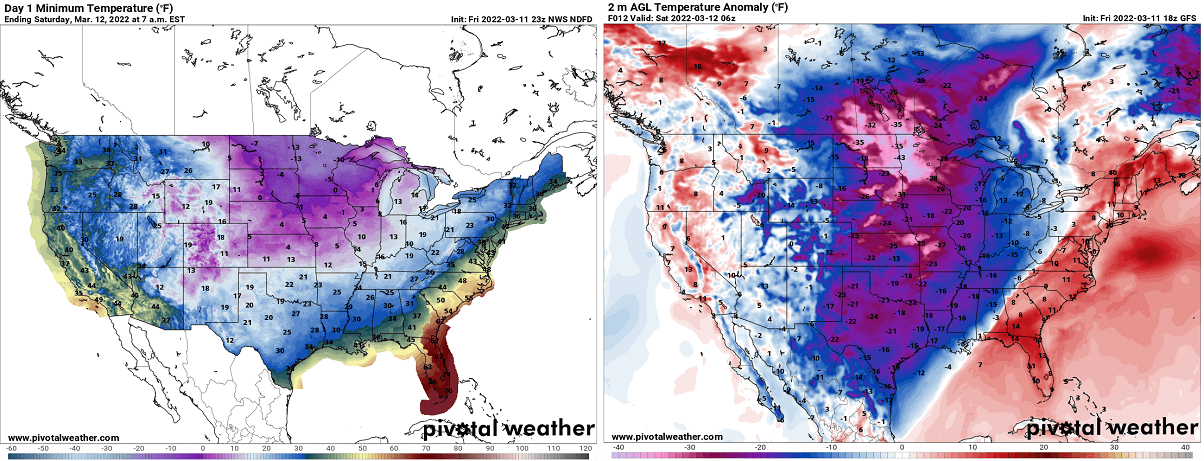
Temperatures on Sunday will be close to 40 °F below normal for mid-March from Mississippi to Georgia, even colder than Alaska for instance.
In our recent general weather forecast for this weekend, we were discussing how the Winter Storm Quinlan will affect millions across the country. The system has delivered decent snow amounts from the central and High plains towards the Mississippi Valley before it is forecast to become a violent surface low as the frontal system ejects off of the Southeast US.
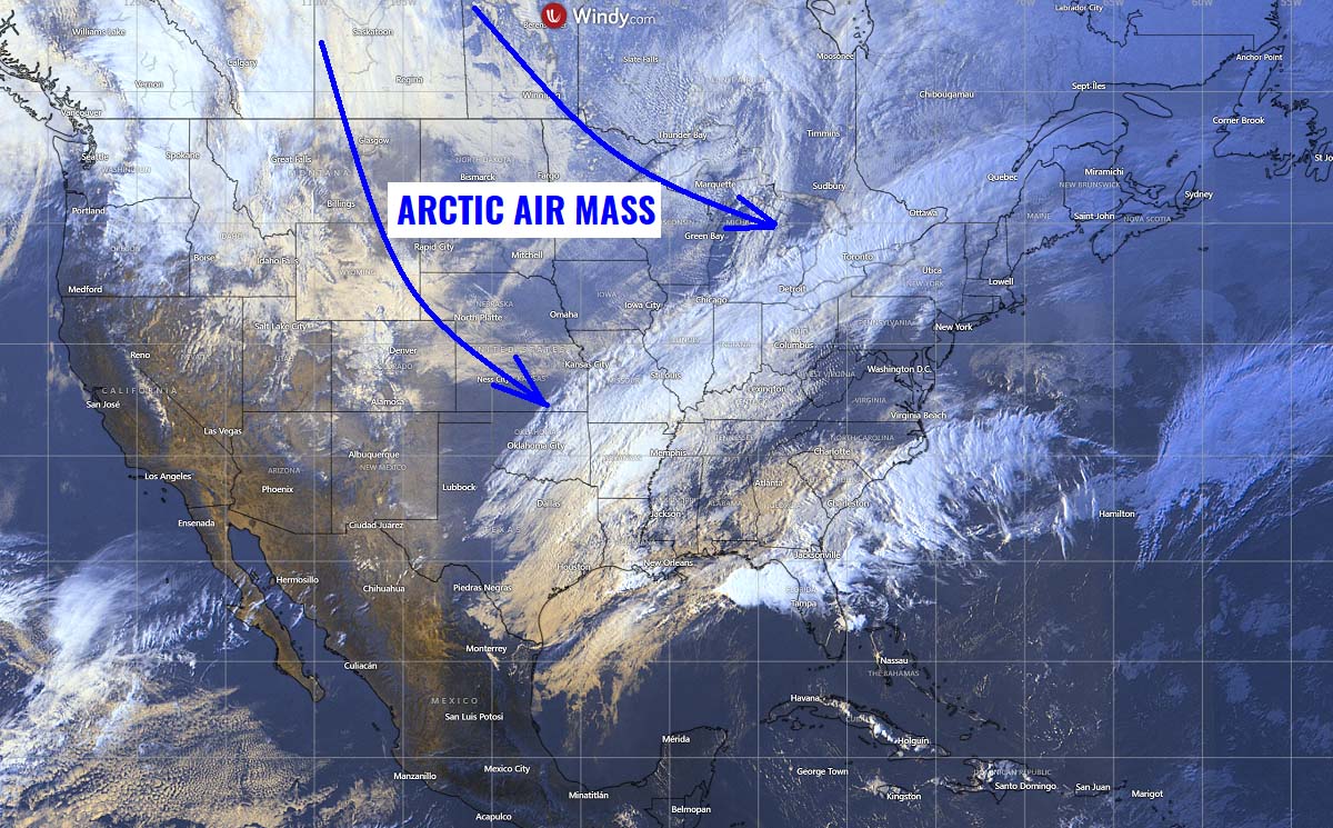
The visible satellite image late Friday revealed the frontal zone from the central U.S. towards the Great Lakes, with snowpack visible from northeast Colorado into Kansas and Nebraska, while eastern Oklahoma, Missouri, and Arkansas had snowfall at that time. Severe thunderstorms are also visible along the eastern Gulf Coast, impacting the Florida coast. Behind the front, the Arctic air mass is rapidly moving south from Canada.
Quinlan is forecast to become a bomb cyclone as the very cold air mass behind the Arctic front interacts with the warm subtropical air mass ahead of it along the East Coast. The system will reach New England late Saturday, delivering a major snowstorm, with severe winds and also blizzard conditions, affecting millions across the Northeast into Sunday.
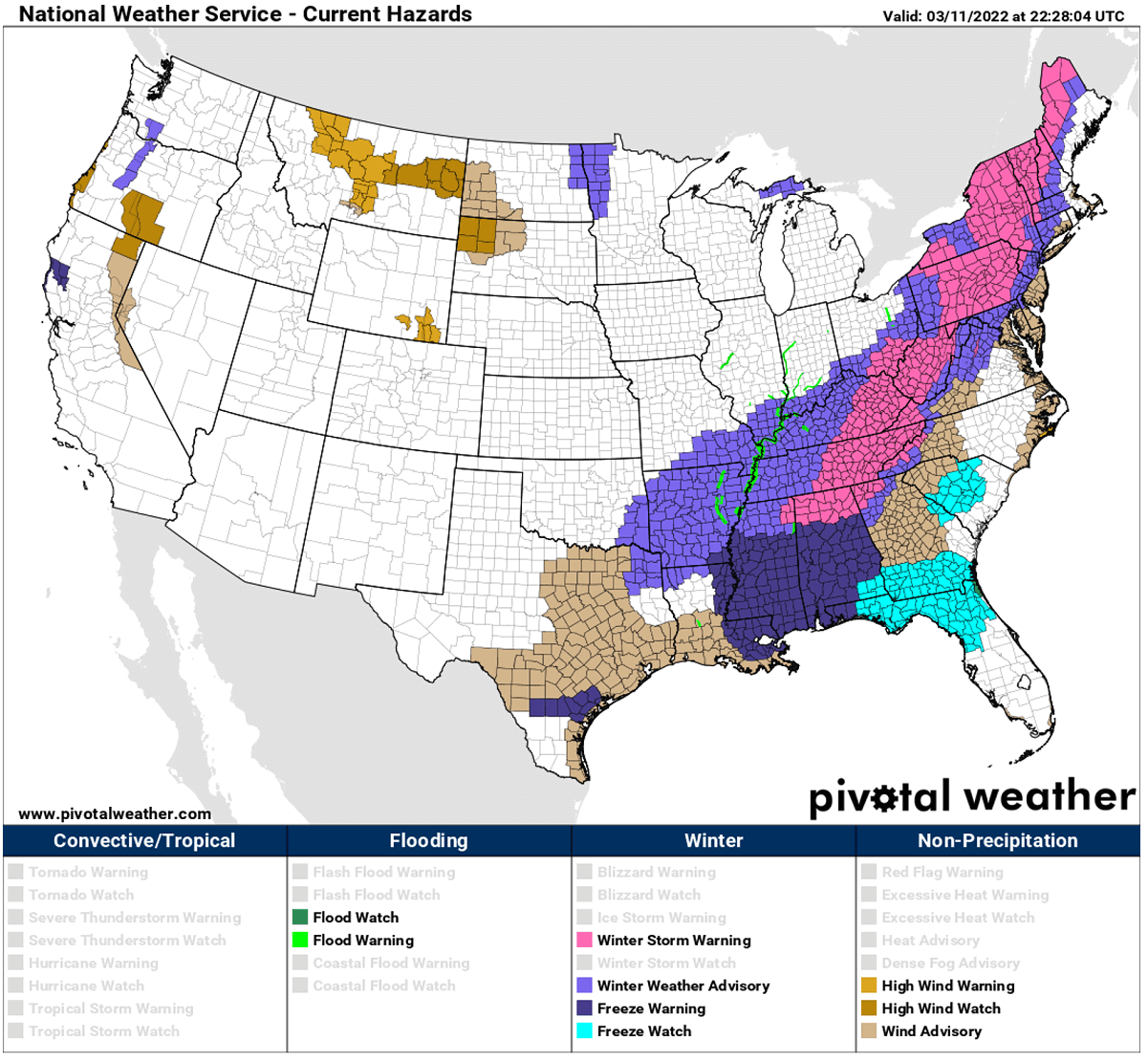
Areas from the southern Ohio Valley into the Northeast are under the effect of winter storm warnings, weather advisories, and freeze warnings across the Southeast.
Following the snow and Arctic front, a significantly colder air mass will spread towards the East and South through Saturday night into Sunday. It will be extremely cold for mid-March, potentially very low temperatures are forecast.
A major cold blast with temperatures around 40 °F below normal will spread into the Southeast, bringing below-freezing temperatures and unseasonably record-breaking cold air along the Gulf Coast from Mississippi to Alabama, Georgia and northern Florida on Sunday morning.
The significant cold could lead to damaging consequences for some agriculture as the potential for a damaging freeze where blossoming and bud break has already occurred with fruit trees.
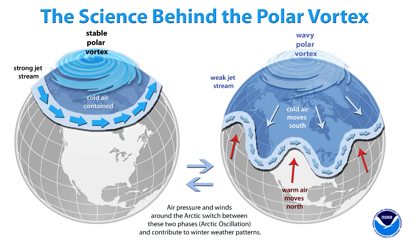
Although we are used to getting cold weather during the winter months, the unusually intense cold outbreak occurring during early spring are those extreme events that are driven by larger-scale patterns. Thus, the main trigger of these events is the Polar Vortex above us. Let’s briefly take a look at how it works, so we understand how and why patterns develop so intensely sometimes.
POLAR VORTEX LOBE TO BLAME FOR THE EXTREME COLD
The Earth’s atmosphere is built of several layers, where the bottom two are the most crucial for our climate and indeed our daily weather. Those are the troposphere and the stratosphere layers, where the Polar Vortex covers most of the bottom half of the atmosphere. The Polar Vortex extends from about the middle of the troposphere up into the stratosphere layer and has the main and major effect on the weather patterns across the high and mid-latitudes every winter.
We were experiencing this kind of winter cold outbreaks and storms quite often across Canada and the U.S. this past winter. This was the effect of the Polar Vortex being unusually intense through most of the Winter Season 2021/22, parked its most defined core, known as the southern lobe, right over the North American continent.
The Polar Vortex is normally the strongest during the winter months and peaks in January and February over the Northern Hemisphere. And although it spins far above our heads, it remains close-connected to the lowest parts of the atmosphere we live in. The Polar Vortex gives our daily weather shape in many different ways, as it works as one large hemispheric circulation in general.
So in general, mainly all the dynamic weather systems we face, from the extreme cold outbreaks across Canada and the United States to the lack of winter weather and snow in Europe this year, have been triggered by the activity of the Polar Vortex above us. It strongly depends on where the southern lobe is positioned.
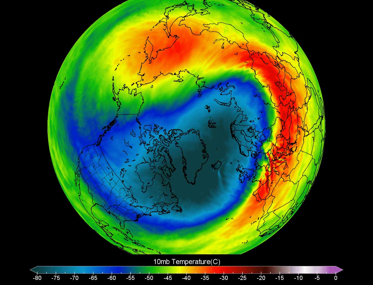
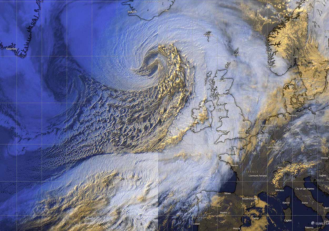
The Polar Vortex last month and into early March was very intense and cold, as we can see from the following weather 10 hPa (10 mbar pressure level) chart below, this level is placed at around 30 km altitude. Just recently, the warming has begun over the American side of the North Pole, and the most intense part of its southern lobe has shifted towards Asia and Europe.
Temperatures in the core of the lobe parked over Europe and Russia are from -70 to -75 °C, which is extremely cold also for these levels for early spring. These temperatures within the Polar Vortex core are nearly 30 °C below normal for this time. We can also see how the temperatures on the other side of the vortex, precisely above Canada and Greenland, are extremely warmer now.
With an average of a few weeks delay in the transport of a cold pool from the upper levels towards the ground layers, this Polar Vortex push of cold outbreak down that we are seeing this weekend is probably the final extreme winter blast for the U.S.
Let’s now focus on the evolution of the record-cold temperatures for the Southeast U.S. on Sunday.
RECORD-COLD FOR THE SOUTHEAST STATES, EVEN COLDER THAN ALASKA ON SUNDAY
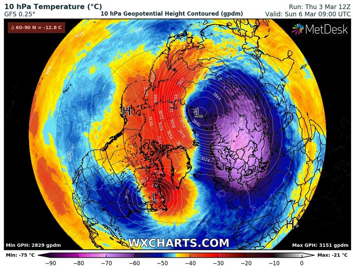
With the delayed effects of the Polar Vortex southern lobe, a strong blocking High strengthening over Canada is gradually expanding towards the United States. A typical effect of the massive continental Arctic airmass intrusion turns towards the south.
The following chart reveals how deep the upper wave is this time, bringing a huge amount of extremely cold air from the higher levels towards the surface.
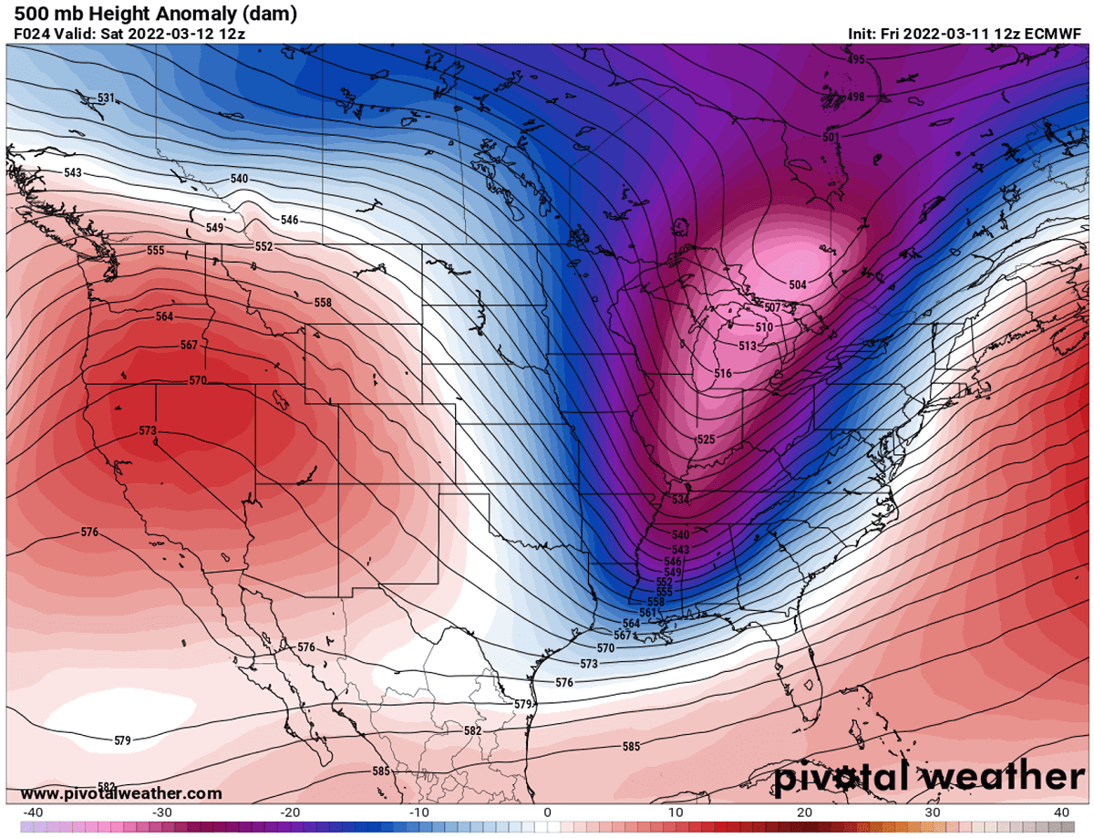
So the surface high developing in its wake will cause the northerly winds to transport a much colder, frigid cold Arctic air mass towards the East and South through Saturday, peaking over the Southeast Saturday night and Sunday.
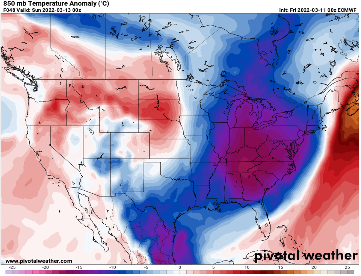
The 850 mbar, which is at approximately 1200 m ASL (4000 ft) above sea level, will bring temperatures about 20 degrees Celsius below normal over this part of the Contiguous U.S.
Saturday will bring the core of the Arctic cold pool across the central parts of the U.S., with temperatures even below -10 °F across parts of North Dakota and Minnesota, single digits across the Midwest, lower tens in southern Kansas and Missouri. The low to mid-20s across a large part of Texas, Oklahoma, Arkansas, and farther east across Ohio Valley.
This means that temperatures will be about 30-45 °F below normal across the northern states and 20-30 °F across Nebraska, Iowa, Kansas, and Missouri. Around 20-25 °F below normal over Texas.
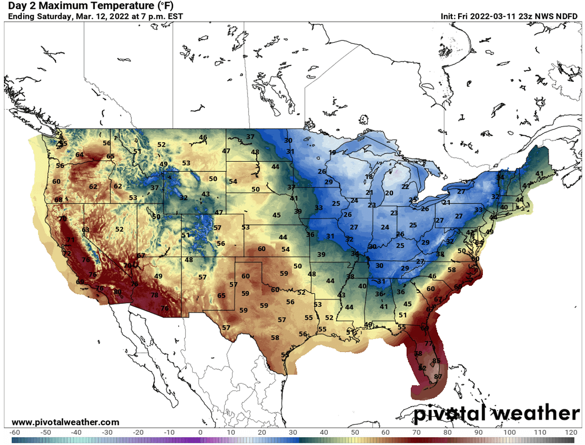
After the very cold Saturday morning, temperatures will be returning into near-normal during daytime from the Rockies into the Plains. Saturday’s high will be in the upper 40s to mid-50s across the High Plains, in the upper 50s to low 60s already across western Kansas, Colorado plains, Oklahoma, and across Texas.
Below freezing temperatures will remain across the Upper Midwest to Ohio Valley and over the Great Lakes, with breezy winds. Very warm day with highs into the upper 70s across central Florida on Saturday, so the flip into Arctic cold will be pretty intense for the next 24 hours.
As the cold across the Southeast will be advancing during the day, many cities will have Saturday’s high temperatures below the normal low temperature on Saturday. Those include Atlanta, Birmingham, and Nashville.
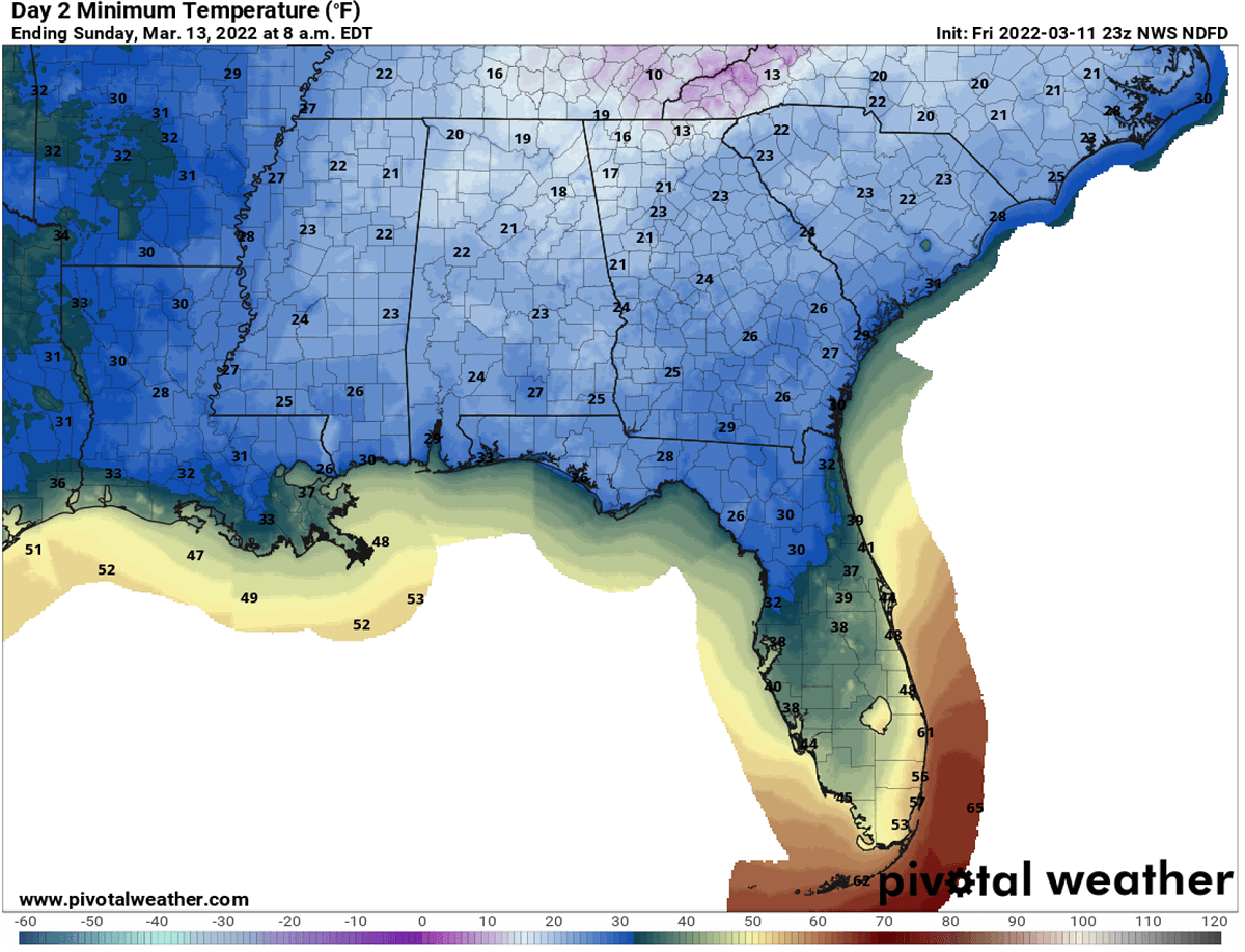
The core of the cold will continue moving east Saturday night, delivering extremely cold and record-breaking temperatures for the Southeast states. While temperatures will be a shy higher across the Plains and quite a lot higher across the northern Plains, the most intense cold will spread over Mississippi, Alabama, Georgia, Tennesee, Kentucky, Carolinas, and northern Florida.
Record-cold temperatures will be nearly 40 °F lower than normal for this time across a large part of the Southeast, the most anomalous over Kentucky, Tennesee, northern Alabama, and Georgia. Notice how much colder than normal will also be temperatures along the whole Gulf Coast, as Arctic blast will spread far south across the Gulf as well.
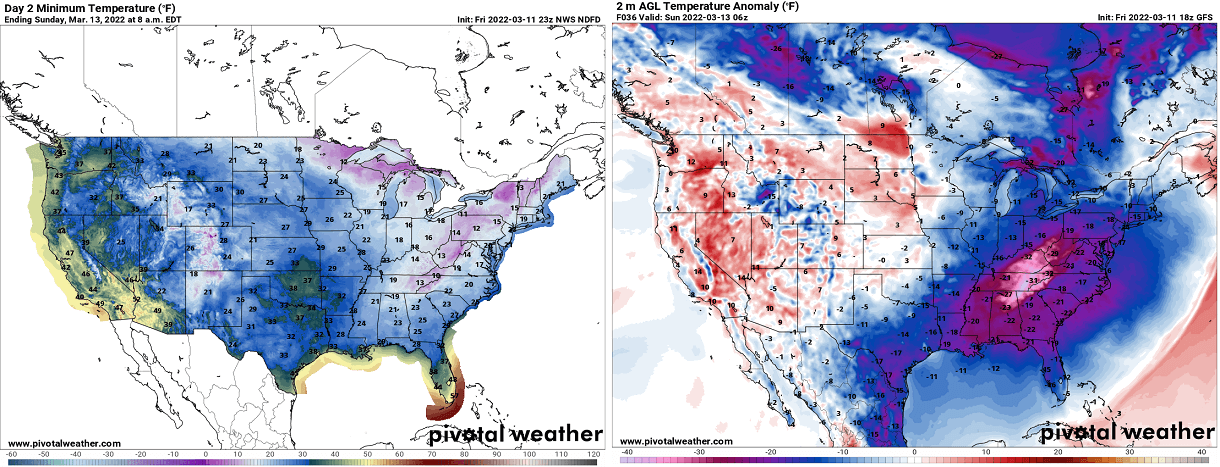
The morning temperatures will be in the low to mid-20s in these areas, with freezing potential also as far south as central portions of the Florida peninsula on Sunday morning. Jacksonville, Florida is forecast to reach below freezing and bottom out at 30 °F. The lowest temperatures will be across northern Georgia, mid 10s are forecast on Sunday morning.
The Tupelo, Mississippi is forecast to cool down to around 20 °F on Sunday morning, potentially setting a new record for a daily low of 21 ° for the city. This would make Tupelo even colder than Anchorage in Alaska, on Sunday morning which is expected to bottom out at 23 degrees F on Sunday morning.
This cold is pretty extreme for mid-March across many areas, and many daily low temperatures will be broken on Sunday. While this is one of the concerns for the agricultures over the weekend, the other feature is the rapidly developing low ejecting to the east.
As we mentioned earlier, the interaction of the very cold Arctic air and the tropical air will lead to explosive development and a rapidly deepening system, becoming a violent Nor’Easter bomb storm.
AN EXPLOSIVE NOR’EASTER WILL BLAST THE NORTHEAST, BOTTOMING OUT AT 930 MBAR ON MONDAY OVER LABRADOR SEA
When we see a very rapid surface pressure falls forecasted within a period of 24 to 36 hours, we classify the cyclonic storm as a bomb cyclone. This means that the surface low is intensifying so fast that its central pressure is falling very (or often extremely) rapidly.
A bomb storm occurs when explosive cyclogenesis is forecast, also known as bombogenesis. When this occurs along the Northeast or New England coast, such systems are then classified as Nor’Easter storms.
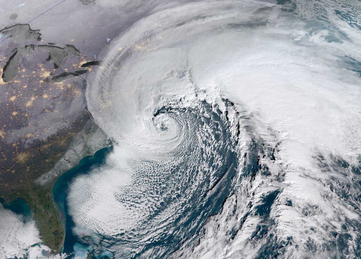
A bomb cyclone is a non-tropical storm, also known as an extratropical low. It develops extremely rapidly from a classic low-pressure system when Arctic cold air masses blast into much warmer, often tropical air mass along the Atlantic East Coast. The satellite image above is a typical Nor’Easter storm along the U.S. coast from the past, very similar to the system we are expecting to see on Sunday.
This kind of storm normally grows very large, dominating a large portion of the Atlantic ocean along the Northeast U.S, their general movement is towards the northeast. The cyclone’s large size produces very intense and often extremely severe, even hurricane-force destructive winds. Having so large size, it also generates major waves and swells, which leads to beach erosion and damages the coastal areas.
Typically, the eastern coasts of the Northwest Atlantic Ocean are the perfect breeding grounds for these types of cyclones, normally from the late fall and winter months into early spring. Very often these Nor’easter storms literally explode over the Atlantic coast. And the perfect example will happen on Sunday again.
The surface low begins rapidly strengthening after exiting the Southeast U.S. Saturday night, interacting with the influx of very warm and moist air from the south. The additional eastward push of the Arctic front from the west we seen above, drags the low towards the Northeast while being explosively deepening into a powerful Nor’Easter.
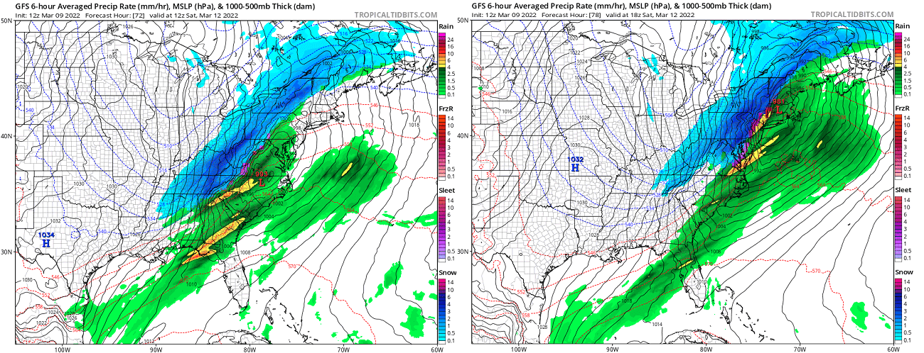
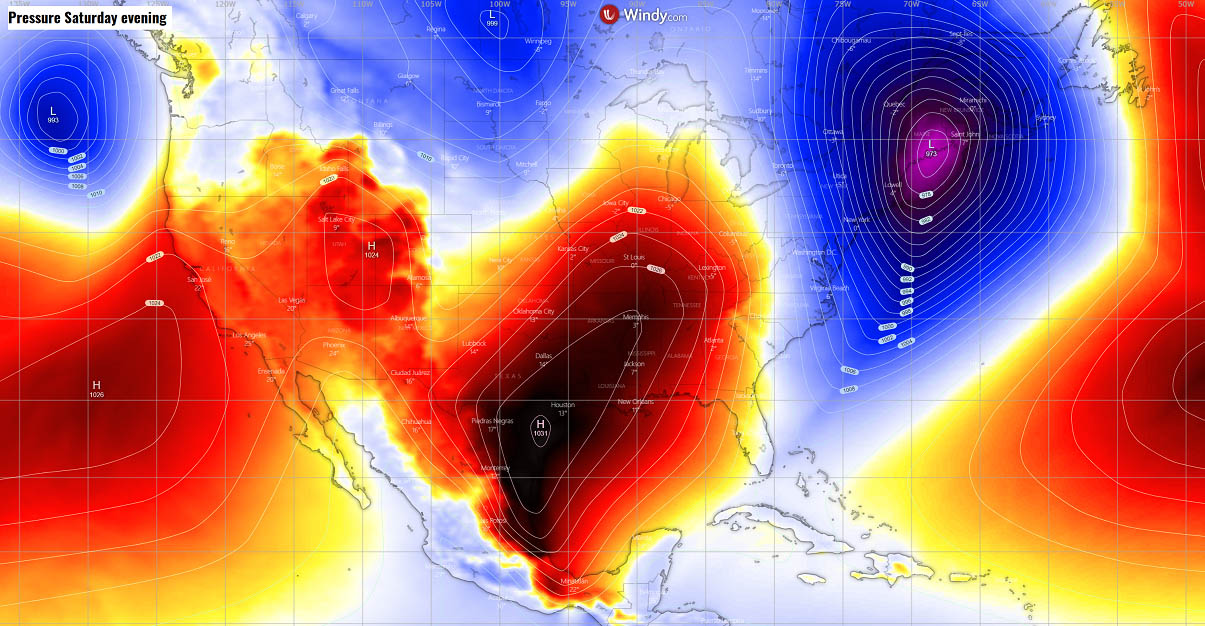
The surface pressure weather chart below indicates the strong pressure difference between the deep Nor’Easter bomb cyclone again the High to the west on Saturday night. We can see more than 60 mbar of pressure difference will be between New England (Low) and the Gulf Coast (High).
And just by looking at the pressure lines (isobars), we can judge the cold, breezy northerly winds will be intense between both systems. This will rapidly deliver Arctic cold air mass into the eastern half of the U.S. on both Saturday and Sunday as we discussed earlier above.
The Nor’Easter is forecast to reach its peak intensity somewhere near the coast of the New England coast on late Saturday, with pressure in the 950s before it continues farther northeast on Sunday.
When the Nor’Ester storm Quinlan emerges across the Mid-Atlantic, its pressure gradient considerably tightens against the higher pressure building up beneath the Arctic cold pool over the land, introducing locally severe winds along the East Coast and New England in particular.
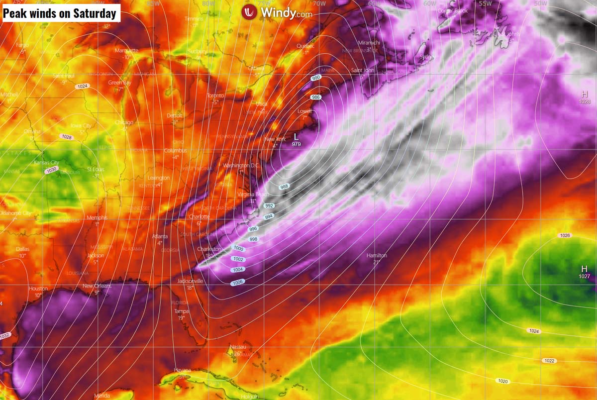
Winds will be the strongest near the coast, causing local flooding and erosion as well, thanks to major waves that will result from the winds as a result of a strong pressure gradient in place. Powerful winds in some coastal areas could be damaging and strong enough to knock out power by fallen trees.
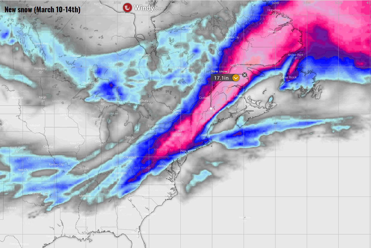
Quite a significant snow amount will develop across much of the mid-Atlantic and Northeast, with a deep snowpack swath from Ohio Valley into New England and farther northeast into eastern Canada later on Sunday. Snowfall will be very heavy in many areas, ending up with around 10-20 inches (possibly up to 25″ in some areas).
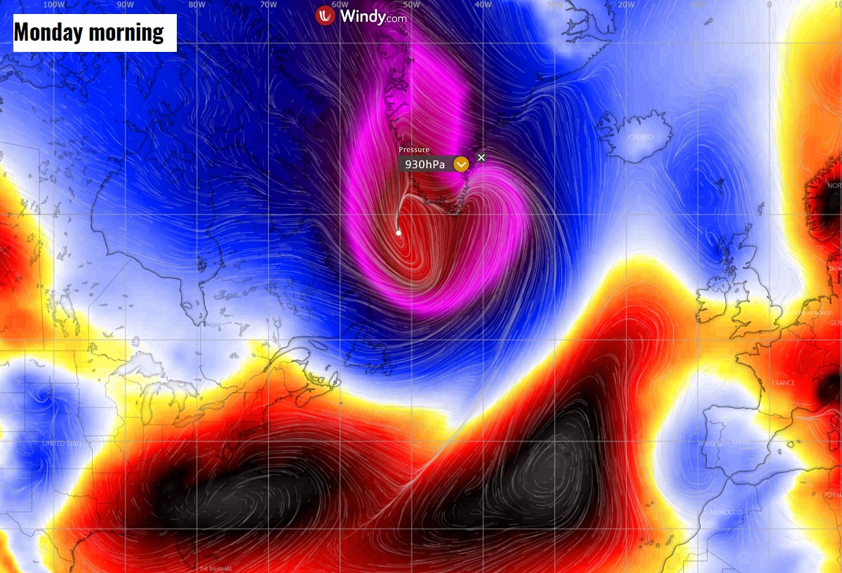
The Nor’Easter will continue rapidly deepening on Sunday, moving across far southeast Canada, blasting Newfoundland with powerful winter storm and winds. It will eject into the Labrador Sea Sunday night, deepening further below 940 mbar.
The system will probably bottom out near or even slightly below 930 mbar on early Monday across the southern Labrador Sea towards the southern tip of Greenland. Winds will be extremely intense, hurricane-force there!
We will have more updates on this evolution soon, stay tuned!
Images used in this article were provided by Windy, TropicalTidbits, and PivotalWeather.
Reference-www.severe-weather.eu