What was that line about shorter weather articles? It’s another “less from the meteorologist = more time outside” kind of day, and kind of weekend.
On Wednesday, we had a couple millimeters of rain and a reasonably solid shot at a weak thunderstorm in our forecast for Friday. Then Thursday’s forecast dropped the thunderstorm potential like a bad habit. Today, even the shower potential for this evening has fallen off drastically; we may see a few sprinkles of rain, but, with a dryer surface layer, even that’s looking less likely. The best chance for rain occurs from 7 pm through 9 pm
The remainder of the weekend forecast is unchanged from yesterday’s article; we’ll experience a glut of additional warmth on Sunday, but Saturday is also aiming above the seasonal marker. The chance of a spotty overnight shower persists.
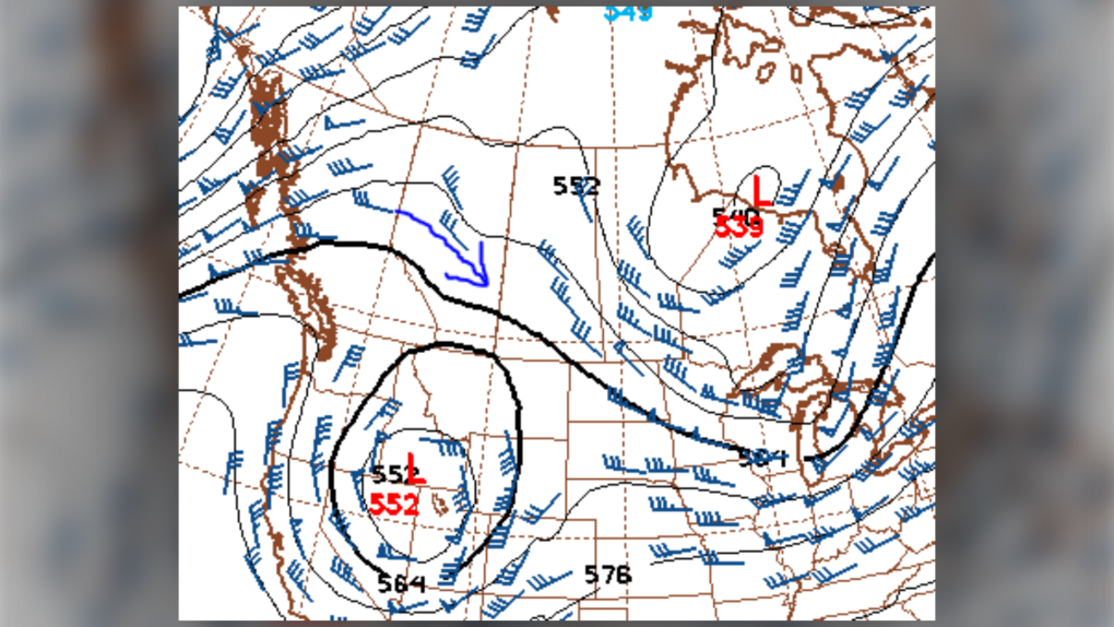
Monday has joined in as a “well above seasonal” sort – and Tuesday remains a little cooler, relatively speaking. The reason: it’s at the onset of a high pressure ridge. We usually spend a day in the entry region (shown in the image, here) before piling into a wave of heat. That’ll be the lead for us next week.
YOUR FIVE-DAY CALGARY FORECAST
Today
- Partly cloudy, chance of late-day showers, risk of thundershowers
- Daytime high: 13C
- Evening: scattered showers, then clearing, low 1 C
saturday
- Partly cloudy
- Daytime high: 15C
- Evening: mostly cloudy, low 4 C
sunday
- Partly cloudy
- Daytime high: 18C
- Evening: some cloud, low 5 C
monday
- Partly cloudy
- Daytime high: 17C
- Evening: shower risk, low 3C
tuesday
- Partly cloudy
- Daytime high: 13C
- Evening: clearing, low 3C
Patrice snapped a neat photo of some bohemian waxwings and felt it by – a good find!
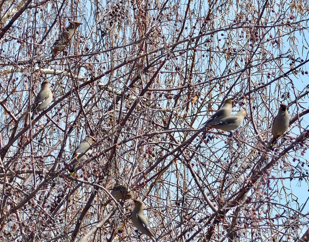 Viewer Patrice’s photo of bohemian waxwings.
Whether it’s wildlife, weather or pets – submit your photos here, email me here, or tweet them over.